Download Red Rock Canyon Map (PDF)

This loop stretches all the way to the southern tip of the open space and then circles back down. This means it is all uphill the first half and all downhill the second, but the grades are generally moderate. The trails are road-width and usually stay on top of the mesa, making them nice and sunny for winter hiking. They parallel the canyons, providing a good view of the formations although not directly among them. Pikes Peak and Garden of the Gods are also a major part of your view. The sky feels expansive, and it is a fantastic place to enjoy the bright blue of a typical Colorado day or to cloud-watch. Start with the trail at the east end of the west parking lot and follow the natural horseshoe, ignoring the sidetrails. The road becomes Greenlee when it begins turning downward, and it will intersect Mesa again near the bottom.
Of the two off-leash dog loops, this is a nice choice because the Lower Dog Loop overlooks Highway 24 and therefore has much more traffic noise and civilization visibility. Lower works fine for those in a hurry; roundtrip mileage from the main parking lot is only half a mile, making it one of the shortest loop hikes in the park. Upper Dog Loop is fairly short as well, about a mile roundtrip, and both fit their purpose of giving your dog freedom to run.
In the 1800s, a quarry was established in Red Rocks, the remains of which are still quite evident and rather interesting to hike through. It is a fun place to take kids, history buffs, and others looking for a story behind their hiking trail. The rocks are among the largest formations in the park, and the quarry work left behind enormous geometric cuts in the rock face. The hiking trail forks on the east side of the quarry, giving you two options for getting up or down the hillside—a normal dirt path that switchbacks, or the steep “miners’ staircase” cut directly into the rock. The stairs are much easier to spot if you approach the quarry from the east side, via the Red Rock Canyon trail. The other option begins with the Mesa trail. From either side, simply look for the Quarry Pass trail, which connects the two. (You can also take Greenlee as a shortcut between Mesa and Quarry Pass.) The loop is just over two miles; with the Greenlee shortcut, it is 1.8 miles.
At the crest of the Mesa/Greenlee loop, there is a connector trail taking you to Section 16 of the Intemann Trail, with very nice rock formations along the way.
This section of the park provides a beautiful view of the rock formations and quarry from above. From the east parking lot, you will see Lower Hogback on your left. It takes you onto the plateau, giving you an overlook of Red Rocks and Pikes Peak before you and the city behind you. Since the mesa is composed mainly of meadows rather than woods or rock formations, it can look a bit bleak in the winter, but it makes a fantastic spot for wildflowers in other times of the year.
Lower Hogback eventually forks, and two basic loops are possible from this point. If you take the downhill choice on the right (Red Rock Rim Trail), you will soon reach another trail branching off on the right, which takes you back to Red Rock Canyon Trail in the heart of the formations. If you take the uphill choice on the left, you will be following Hogback Valley Trail, which continues to give you an overlook of the canyon and eventually becomes the Lion Trail, looping around to the same intersection where you started. The Lower Hogback/Red Rock Rim/Red Rock Canyon loop is about 2.5 miles, whereas the Lower Hogback/Hogback Valley/Lion loop is 3.3 miles.
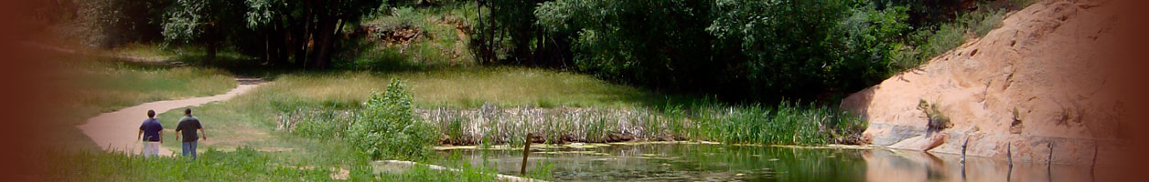
Some wanted to call Red Rock Canyon the “Garden of the Goddesses,” but the apt name did not go to waste—there is a club by that title which helps build and maintain the trails. In particular, the Garden of the Goddesses built the Contemplative Trail, which is off-limits to bikes and horses because the members wished to honor the sacred, meditative quality of the area and therefore dedicated it to hiking only. The Contemplative Trail skirts especially close to the rock formations, often traversing between two rock walls, making it a quiet route separated from the noise of traffic and neighborhoods. Several pine benches have been installed along the trail, and many more natural benches can be found on the rocks for your sitting and meditating enjoyment. You can make the hike a loop by starting at the Sand Canyon trailhead at the west end of the parking lot. The Contemplative Trail begins and ends from Sand Canyon, so you can hike up one and down the other. The loop’s roundtrip length from the parking lot is about 1.75 miles.